Posts

Tropical Storm Andrea Makes Her Move North

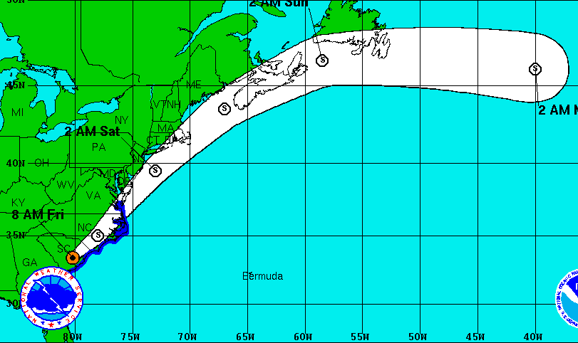
The first named storm of the 2013 Atlantic hurricane season is poised to make her move on much of the East Coast today and tomorrow, but the storm is weakening and could lose tropical characteristics by the time it reaches the mid-Atlantic region.

Tropical Storm Andrea dumped heavy rains on Florida and Georgia and spawned a series of tornadoes as it made landfall. According to the National Hurricane Center, the storm’s projected track has it cutting across the Carolinas and then heading back over water as it swings past Delaware and New Jersey. The good news for Pennsylvania is that the projected path has shifted to the east over the past 12 hours, but the storm could still bring heavy rains to the southeast portion of the Keystone State late Friday and early Saturday.

As of 8:00am Friday, maximum sustained winds associated with Andrea had dropped to 45 miles per hour, down from 60.


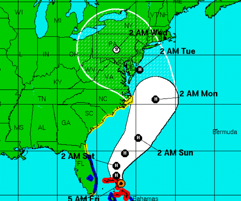
Latest Forecast Tracks Bring Sandy to Pennsylvania on Tuesday & Wednesday

The effects of Hurricane Sandy may reach Pennsylvania as early as Sunday, but according to the National Hurricane Center the storm itself is expected to come ashore near the New Jersey-Delaware border and then track directly over Pennsylvania late Tuesday and into Wednesday.

The main concern is that the tropical storm could collide with a westward-moving early winter system and park itself over the region for days, bringing heavy rains, winds and possibly snow in higher elevations. Officials are urging everyone in the path of Sandy to use their time wisely this weekend, preparing emergency kits with at least three days of drinking water and other necessities, as well as clearing storm drains and spouting, which may be clogged with fallen leaves.

A spokesperson for the Pennsylvania Emergency Management Agency says this potential “superstorm” could bring prolonged power outages that may last several days.

Hurricane Irene Could Impact Pennsylvania Weather, Depending on Track

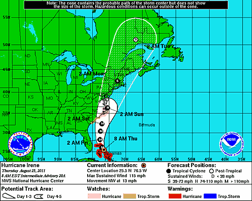
Hurricane Irene  potential path may bring it close enough that it could impact parts of Pennsylvania this weekend. The latest forecast has it taking a slightly more westward track.

Walter Drag, with the National Weather Service in Mount Holly New Jersey, says it’s a large storm that could have some impact on Pennsylvania, depending on the track it takes up the coast.

Drag says some areas that had heavy rain recently, in Eastern Pennsylvania, New Jersey, Northern Delaware and Northeastern Maryland could be facing another bout of heavy rain as the result of Irene.

Drag says even if the storm passes off to the east, a predecessor rainfall event could still bring some rain to eastern parts of the state.  Predecessor events can be associated with tropical systems.  They are not part of the bands of rain directly caused by the hurricane or tropical storm.

Drag says if the storm comes closer, it could bring squally winds and heavy rainfall. The Philadelphia area could get anywhere from a fraction of an inch to more than five inches, depending on the track of the storm.

Drag says people who have weekend plans along the coast should pay special attention to the National Hurricane Center forecasts.   The head of FEMA says people along the entire Eastern Seaboard need to pay attention to Hurricane Irene. 


**Chart courtesy of the National Hurricane Center